Saturday, February 19, 2011

The "Historical 3D layer",revisited

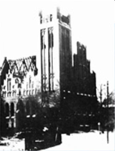
Some time ago, blogger and 3D modeller Zoungy wrote a post about the possibility of having a "Historical 3D layer" in Google Earth, i.e. a separate layer including terrain and models of buildings from 50, 100, or even 200 years ago. In Germany, this would mean, for example, 1920s Berlin, or Potsdam before the the bombings. Just think how great cities like Frankfurt am Main or Nuremberg would look with their old buildings rebuilt in 3D.

In Berlin, for example, we would be able to see the old Potsdamer Platz, with its hotels and restaurants, or an impressive view of the Unter den Linden boulevard towards the Stadtschloss. A picture including the old excise wall (Gr. Aksizemauer) with its 18 gates. Maybe, even a reconstruction of the Berlin Fortess could also be possible.

In Google Earth, some German cities have historical imagery dating back from 1943, before being bombed. Big cities like Frankfurt am Main, Dresden, Köln, Lübeck, Nuremberg, Berlin, Stuttgart, Hamburg, Frankfurt an der Oder, Magdeburg, Leipzig, Göttingen, Koblenz, Freiburg, Hannover and Kiel are an example of this. While this pictures are not in HQ, modelers can use them as a reference for the location of old buildings. Former German cities in this category include Straßburg in the Alsace, Danzig in former West Prussia, and Breslau in Sliesia.

Berlin also has good quality imagery from March 1945, that covers Tiergarten, part of Moabit Potsdamer Platz, part of Mitte (without part of Friedrichstadt and the area around Gendarmenmarkt), , and Tempelhof airport, comprising a total area of 16.5 km2. Also, there is a 1950 archive covering all of Berlin and part of Potsdam.

Basically, there are three main problems regarding the historical imagery. First, the quality of the 1943 archive should be improved to have a clear view of the blocks and streets. Second, the imagery should match with the most recent pictures (usually, old pictures are displaced). Finally, the pictures should be colored to give the feeling of reality. Once those questions have been solved, we will be able to travel back in time and enjoy the beauty of the great German cities.

Monday, February 14, 2011

Berliner Stammstrecke, Busmannkapelle


109 years ago, the first line of the Berlin metro (Untergrundbahn, U-Bahn for short), was inaugurated by Kaiser Wilhelm II. This first line (known as the Stammstrecke), now part of the U1 and U2, ran from Stralauer Tor (in the eastern end of the Oberbaumbrücke) to Zoologischer Garten, and served 12 stations: Stralauer Tor, Schlesisches Tor, Oranienstraße (today Görlitzer Bahnhof), Cotbusser Thor, Prinzenstraße, Hallesches Tor, Möckernbrücke, Gleisdreieck, Bülowstraße, Nollendorfplatz, Wittenbergplatz and finally, Zoologischer Garten, in addition, a short track ran from Gleisdreieck to Posdamer Platz. In the same year, the service was extended eastwards to Warschauer Brücke (today Warschauer Straße), and Knie.

Viaduct under construction: Wassertorplatz, between Prinzenstraße and Cottbuser Thor

Early on this day, I uploaded to the Warehouse two of these stations, which had different fates: Stralauer Tor and Nollendorfplatz.

U-Bahnhof Stralauer Tor, 1902

Stralauer Tor, located in the eastern end of the Oberbaum bridge in Friedrichshain, received its name after the historical city gate of the Berlin customs wall (Akzisemauer), located in the same spot. The station served as the U1 terminus until the completion of Warschauer Brücke, later that year. Stralauer Tor was renamed Osthafen in 1924, and continued to serve using that name until WW2. In March 1945, the elevated station was heavily damaged by Allied bombing. The Communist authorities decided not to rebuild U-Bhf. Osthafen because of its close proximity to the boundary between Sovied and American occupation sectors (i.e. East and West Berlin).

Named after the village of Naklérov in today Czech Republic (site for the 1813 battle of Kulm), U-Bahnhof Nollendorfplatz is located in the square of the same name in Berlin-Schöneberg. It was subject to many modifications - the eastern entrance hall was modified in the interwar years, first in 1923 and later in 1926/27. The structure from 1927 is the only part that remained until our days.


Again, Allied bombing left the station unsuitable for service (the eastern end of the elevated building had collapsed). Damage was partly repaired and by the early 1950s the station was back in service. However, the remains of the old building were demolished, and the current new structure was built. By the same time, the square, lost its old shape. On 1999 a simplified dome was added to the building, but unlike the original dome, it is just an ornament.


Other stations had a different fate. U-Bahnhöfe Oranienstraße and Warschauer Straße are almost in their original condition; U-Bahnhöfe Wittenbergplatz and Schlesisches Tor survived the war intact; U-Bhf. Bülowstraße was enlarged in 1929; the stations Cottbusser Thor and Möckernbrücke were demolished and rebuilt in the 20s and 30s, the former 170m westwards as a two-level station, and the latter had a new structure built because of increased number of passengers; Hallesches Tor and Prinzenstraße survived with postwar modifications.

At the same time, on a totally different context, I uploaded the model of the Busmannkapelle in Dresden. The Sophienkirche, Dresden oldest church, was originally part of the Franciscan monastery (Dresdner Franziskanerkloster), that was demolished around 1330 for the construction of a new, Gothic church.


As we all know, the Busmannkapelle, along with the Sophienkirche and the Dresden city center burned after the devastating air raid carried out by Allied forces in the nights of February 13th and 14th. This is an excerpt from a letter written by American ssoldier Kurt Vonnegut, who had been captured the year before, and was imprisoned in a underground slaughterhouse in Dresden by the time of the attack.
On about February 14th the Americans came over, followed by the RAF, their combined labors killed over 250.000 people in twenty four hours and destroyed all of Dresden - possibly the world's most beautiful city.

The Sophienkirche was gutted by the resulting inferno. However, the structure remained standing and a restoration could have been possible. Sadly, the ceiling and part of the the northern tower collapsed in 1948 as a result of the damage. Its fate was uncertain until 1950, when the SED party chief Walter Ubricht commented that "a socialist city doesn't need gothic church towers", dooming the church. Despite the protests by architects and overall population, the Sophienkirche remains were blown up in 1962.


I hope to make an extended post about the Sophienkirche later. I'm currently making the 3D, but I need more color pictures.

Thursday, February 3, 2011

Schneidemühl II - Main station and demolished church

In the last two weeks I have uploaded some new models to the Warehouse. Almost all of these buildings are located in Schneidemühl, today Piła, in Poland. The first one is the Piła Main Station complex, known as Piła Główna in Polish.

The Hauptbahnhof Schneidemühl complex was built between 1851 until the 1876, when the city was part of the Province Posen in the Kingdom of Prussia. By those years, the complex, which included a train depot 430 m. eastwards, became an important part of the Prussian Eastern Railway that connected Berlin with Königsberg, and in the following years new lines were built connecting Piła with Posen, Neustettin, Flatow, Bromberg, Danzig, Frankfurt on the Oder and Wałcz (Gr. Deutsch Krone).

Picture from schneidemuehl.net.

The station was extended westwards in the 1920s, by those years the building lost its initial ornaments and took its current shape. The building survived WW2 unscathed.


Regarding the train depot from 1874, it fel into disuse in the 1990s. The main part of the depot, i.e. the roundhouse, is waiting for a restoration. You can find more information and pictures in this website (not mine).

The next model is the Johanniskirche, which didn't have enough luck to survive to these days.

Picture from schneidemuehl.net.Note that the house next to it is still standing.

The Protestant Church of St. John (św. Jana in Polish) was built between 1909 and 1911 in a Neogothic style by German architect Friedrich Oskar Hoßfeld as home to a United Prutestant congregation.

Picture from dawna.pila.pl.

As you can see above, the church resulted with moderate damage (the roof and spire burned down), but could have been easily restored. However and as usual, the Communist government decided to blow up the building, as it did so in the 1950s. Three other churches suffered a similar fate.

As happens usually with other buildings that do not exist anymore, the geometry work was the easy part. However, looking for other churches with similar caracteristics and some reference pictures was enough to get such a beautiful result. I hope this model to serve as a basis for a future reconstruction in Piła, one day. Enjoy.