Showing posts with label Bahnhöfe. Show all posts

Tuesday, February 14, 2012

Two more models are expected to be avaliable for Google Earth in the next days:

Let's start with U-Bhf. Hallesches Tor.

As with some other U-Bahn stations in Berlin, Hallesches Tor was named after a historical city gate, in this case, Hallesches Tor was the start of the road that led to the city of Halle upon the Saale, in present-day Saxony-Anhalt.

Hallesches Tor around 1800

The station was built close to the former location of the gate, and opened in February 1902 as part of the Stammstrecke, first U-Bahn line.

During construction, 1902

Hallesches Tor, c.1902

The station was damaged by bombing during WW2, and had to be closed in April 1945. The structure was rebuilt in the following years.


The second model is an addition to Dresden cityscape, of course, I'm talking about the Taschenbergpalais.

Taschenbergpalais, Sophienkirche and Zwinger c. 1940

This baroque palace was built by Johann Friedrich Karcher for Countess Anna Constanze of Hoym between 1705 and 1708. This structure stood there for over 230 years, before being heavily damaged by the Allied bombing that destroyed most of Dresden in February 1945. The ruins would remain there for the next 47 years, until the construction of the current structure, which serves as a Kempinski hotel since its completion in 1995.

The Taschenbergpalais ruins in 1990


And for anyone who hasn't noticed it yet, the Berliner Stadtschloss is avaliable for download as a KMZ file since January 17th, to conmemorate the creation of the Kingdom of Prussia and the proclamation of the German Empire in January 18th, 1701 and 1871, respectively. Enjoy!

Monday, February 14, 2011

Berliner Stammstrecke, Busmannkapelle


109 years ago, the first line of the Berlin metro (Untergrundbahn, U-Bahn for short), was inaugurated by Kaiser Wilhelm II. This first line (known as the Stammstrecke), now part of the U1 and U2, ran from Stralauer Tor (in the eastern end of the Oberbaumbrücke) to Zoologischer Garten, and served 12 stations: Stralauer Tor, Schlesisches Tor, Oranienstraße (today Görlitzer Bahnhof), Cotbusser Thor, Prinzenstraße, Hallesches Tor, Möckernbrücke, Gleisdreieck, Bülowstraße, Nollendorfplatz, Wittenbergplatz and finally, Zoologischer Garten, in addition, a short track ran from Gleisdreieck to Posdamer Platz. In the same year, the service was extended eastwards to Warschauer Brücke (today Warschauer Straße), and Knie.

Viaduct under construction: Wassertorplatz, between Prinzenstraße and Cottbuser Thor

Early on this day, I uploaded to the Warehouse two of these stations, which had different fates: Stralauer Tor and Nollendorfplatz.

U-Bahnhof Stralauer Tor, 1902

Stralauer Tor, located in the eastern end of the Oberbaum bridge in Friedrichshain, received its name after the historical city gate of the Berlin customs wall (Akzisemauer), located in the same spot. The station served as the U1 terminus until the completion of Warschauer Brücke, later that year. Stralauer Tor was renamed Osthafen in 1924, and continued to serve using that name until WW2. In March 1945, the elevated station was heavily damaged by Allied bombing. The Communist authorities decided not to rebuild U-Bhf. Osthafen because of its close proximity to the boundary between Sovied and American occupation sectors (i.e. East and West Berlin).

Named after the village of Naklérov in today Czech Republic (site for the 1813 battle of Kulm), U-Bahnhof Nollendorfplatz is located in the square of the same name in Berlin-Schöneberg. It was subject to many modifications - the eastern entrance hall was modified in the interwar years, first in 1923 and later in 1926/27. The structure from 1927 is the only part that remained until our days.


Again, Allied bombing left the station unsuitable for service (the eastern end of the elevated building had collapsed). Damage was partly repaired and by the early 1950s the station was back in service. However, the remains of the old building were demolished, and the current new structure was built. By the same time, the square, lost its old shape. On 1999 a simplified dome was added to the building, but unlike the original dome, it is just an ornament.


Other stations had a different fate. U-Bahnhöfe Oranienstraße and Warschauer Straße are almost in their original condition; U-Bahnhöfe Wittenbergplatz and Schlesisches Tor survived the war intact; U-Bhf. Bülowstraße was enlarged in 1929; the stations Cottbusser Thor and Möckernbrücke were demolished and rebuilt in the 20s and 30s, the former 170m westwards as a two-level station, and the latter had a new structure built because of increased number of passengers; Hallesches Tor and Prinzenstraße survived with postwar modifications.

At the same time, on a totally different context, I uploaded the model of the Busmannkapelle in Dresden. The Sophienkirche, Dresden oldest church, was originally part of the Franciscan monastery (Dresdner Franziskanerkloster), that was demolished around 1330 for the construction of a new, Gothic church.


As we all know, the Busmannkapelle, along with the Sophienkirche and the Dresden city center burned after the devastating air raid carried out by Allied forces in the nights of February 13th and 14th. This is an excerpt from a letter written by American ssoldier Kurt Vonnegut, who had been captured the year before, and was imprisoned in a underground slaughterhouse in Dresden by the time of the attack.
On about February 14th the Americans came over, followed by the RAF, their combined labors killed over 250.000 people in twenty four hours and destroyed all of Dresden - possibly the world's most beautiful city.

The Sophienkirche was gutted by the resulting inferno. However, the structure remained standing and a restoration could have been possible. Sadly, the ceiling and part of the the northern tower collapsed in 1948 as a result of the damage. Its fate was uncertain until 1950, when the SED party chief Walter Ubricht commented that "a socialist city doesn't need gothic church towers", dooming the church. Despite the protests by architects and overall population, the Sophienkirche remains were blown up in 1962.


I hope to make an extended post about the Sophienkirche later. I'm currently making the 3D, but I need more color pictures.

Tuesday, October 12, 2010

Kottbusser Tor

Kottbusser Tor was one of the original city gates, part of the so-called Berliner Zollmauer; the road through the gate lead to the town of Cottbus (Brandenburg). Both the U-Bahnhof and the area where it stands are named after the gate. However, that location is not where the original U- Bhf. Kottbusser Tor once stood.

U1 train type A3, leaving Kottbusser Tor on its way to Görlitzer Bahnhof.

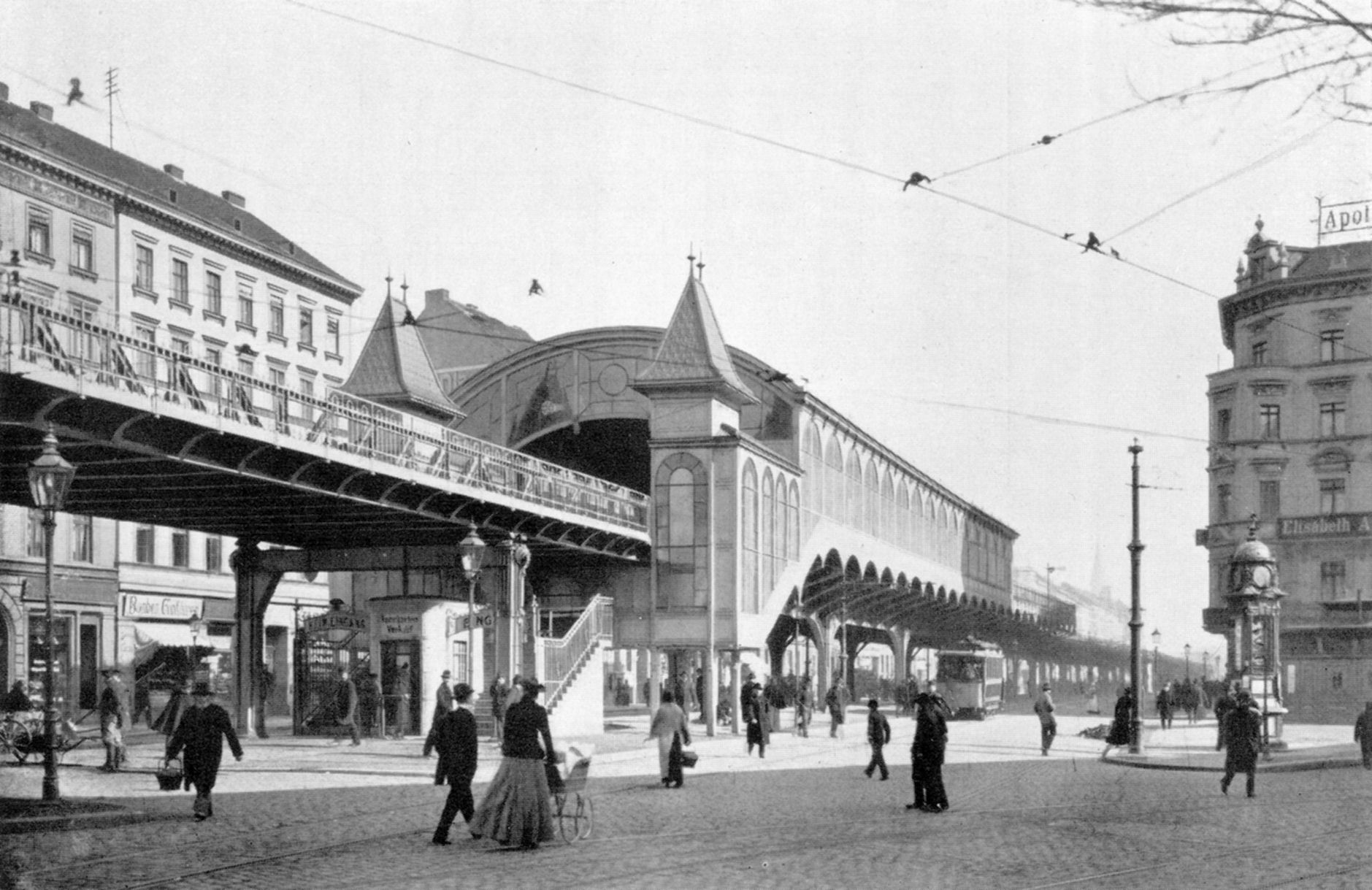
The first station opened on February 18, 1902 as part of the U1 line. It was located near the corner of Mariannenstraße and Skalitzer Straße, and, as you can see in the picture below, shared the same shape of the U-Bhf. Oranienstraße (now Görlizter Bahnhof) .


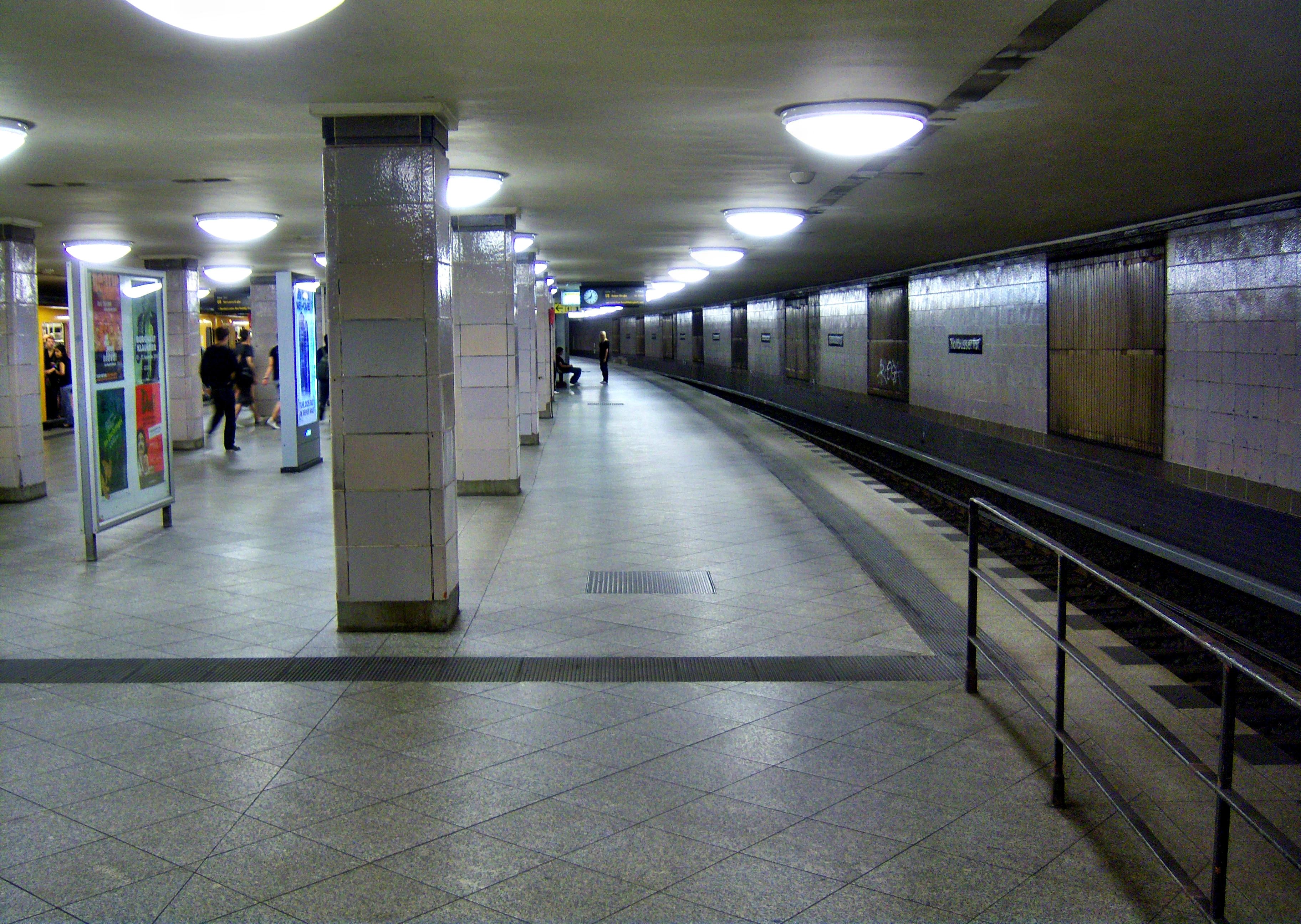
This Station was demolished in 1926 following the construction of the U8 line. The current station was built ca. 170m westwards, and is now a two level station - The U1 platform is located in the elevated structure, and the one serving U8 is below ground level.

View of underground platform for the U8 line.


I also invite you to visit this interesting site (not mine), which has information and pictures of old U-Bahn stations. The website is in German, but I'm sure you will be easily able to understand.

Sunday, October 3, 2010

Für Berlin, und Deutschland

As a gift to the German people in their holiday, today October 3, I have uploaded two new models to the Warehouse.

The Wittenbergplatz U-Bahnhof is one of the oldest U-Bahn stations in Berlin, having opened in March 1902. Here is a photo showing the first entrance.


In 1913, this entrance was replaced with a large hall built by architect Alfred Grenander in the Art Nouveau style. In 1952, the London Transport Board donated a London-Underground-like sign to conmemorate the 50 anniversary of the U-Bahn system (you can see the roundel as the logo of the model in the Warehouse).


Located in Kreuzberg, U-Bahnhof Görlizer Bahnhof opened in February 1902 as "U-Bhf Oranienstraße".


In 1926 it was renamed after the nearby Görlitzer Bahnhof, a railway terminus serving the mainline link connecting Berlin to Cottbus (Brandenburg), Görlitz (Saxony), Breslau (Silesia), and Vienna (Austria). The terminus was damaged in WW2 and demolished in the 1960s; however, the U-Bahnhof is preserved almost in its original condition.


Sunday, May 23, 2010

Stettiner Bahnhof ( II )

This is the suburban railway station (Vorortbahnhof), the only remaining structure from the old Stettiner Bahnhof. The Vorortbahnhof was built in 1897 according to plans of railway inspector Armin Wegner, and served as railhead station for the suburban railway between that year and 1924, when the first S-Bahn train left from there for Bernau.


As part of the Nord-Süd-Tunnel (North-South Tunnel) for the S-Bahn system, an underground station was built in Invalidenstraße, and replaced the old Vorortbahnhof. 

The Vorortbahnhof resulted slighty damaged in WW2. It still stands in Zinnowitzer Strasse, covered with graffitis, waiting for use and a restoration. 

Saturday, May 22, 2010

Stettiner Bahnhof ( I )


Today I finally finished the Stettiner Bahnhof. It was a bit difficult to get textures, and the only color pictures I found were two postcards, and two photos showing a damaged, ruined station - I had to create some textures, using one photo I found in Wikimedia.

The Stettiner Bahnhof was first built at 1842, as the Berlin terminus of the railway connecting the city with the port city of Stettin and the resorts on the Baltic Sea. Because of the increasing number of passengers, the Stettiner Bahnhof was extended first in 1871 and later in 1903, when three smaller train sheds (each one with one track) were built.

The terminus was damaged by the Allied bombing of Berlin, although the structure remained in a relative good status. After Germany was stripped - again - of her eastern territories, the name of the station was changed to Nordbahnhof. The terminus closed in 1952, and was demolished ten years later.


Sunday, April 18, 2010

Anhalter Bahnhof

Finally, I did it. This is the finished Anhalter Bahnhof in Berlin, Germany. By the time it was built, the Anhalter Bahnhof was the biggest railway station in continental Europe.


The air raids of November 1943 and February 1945 devastated the station. The building was demolished in 1960-61, although the central portion of the façade and the eastern part of the Güterbahnhof (goods station) were left standing.

Wednesday, April 14, 2010

And more Bahnhöfe

Today two new models were accepted in Google Earth 3D Layer.

First, the Berlin Hauptbahnhof.


The Berlin Central Station (Hauptbahnhof, or simply Hbf) is the main railway station in Germany and the largest crossing station in Europe. It was built between 2001 and 2006 on the site of the Lehrter Bahnhof/Stadtbahnhof. The Hbf has served as the Central Station of Berlin since 26 May, 2006. Before that, a part of the in-work building was used as S-Bahnhof ("Hauptbahnhof - Lehrter Bahnhof").

Well, this model is not so new - I made (and uploaded it) on April 3th evening. The difficult part of it was the S-Bahn route, since it's made of about 20 arches, as you can see. In this model, I made only one arch, and then copied and resized it according to the width of that part.

New Mosse-Palais

The Mosse-Palais ("Mossepalais, "Mosse Palais" or "Palais Mosse") was a building located in Voßstraße, first property of Rudolf Mosse. The façade at Voßstraße was made of Sliesian sandstone, and the front at Leipziger Platz was provided with a relief of scluptor Max Klein (called "The Survey of German Genius", Die Erhebung des deutschen Genius). The old Mosse-Palais was destroyed (along other historical buildings) in November 1943 by a massive air raid.


I'm already working on the old Mosse-Palais (actually, I first started it), but since there are no more than three useful pictures, it will be difficult to get it textured soon.

Sunday, April 11, 2010

Bahnhöfe / Railway Stations

In the last two weeks I was working on three Berlin railway stations (all gone). Two of the models are finished (I will finish Anhalter Bahnhof this week).

Lerther Bahnhof

The Lehrter Bahnhof was built in 1871, in a French neo-Renaissance style, unlike other train stations (which were made with brick façades). It served as the terminus of the Berlin-Hannover railway via Lehrte. The train shed was 188 meters long and 38 meters wide. The Bahnhof took over the functions of the nearly Hamburger Bahnhof in 1888.

Damaged in the Second World War (1943 bombing of Berlin), the Bahnhof was partially repaired. However, after West Berlin became a West German enclave, the Lehrter Bahnhof was demolished between 1957 and 1959.

Lehrter Stadtbahnhof

The Lehrter Stadtbahnhof opened in 1882. It was located at the northern end of Lehrter Bahnhof, ant was part of the Stadtbahn system, and became an S-Bahnhof in 1930. The building survived WW2 almost intact, and became a listed building in 1987, however, it was demolished in 2002.


It was difficult to get textures for this model, since there are few of them, most of low-quality.